Client
BAM Nuttall
Case Study - Don Viaduct
What's the Story?
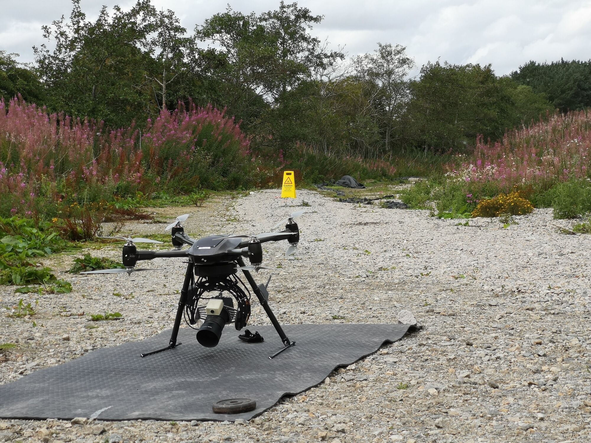
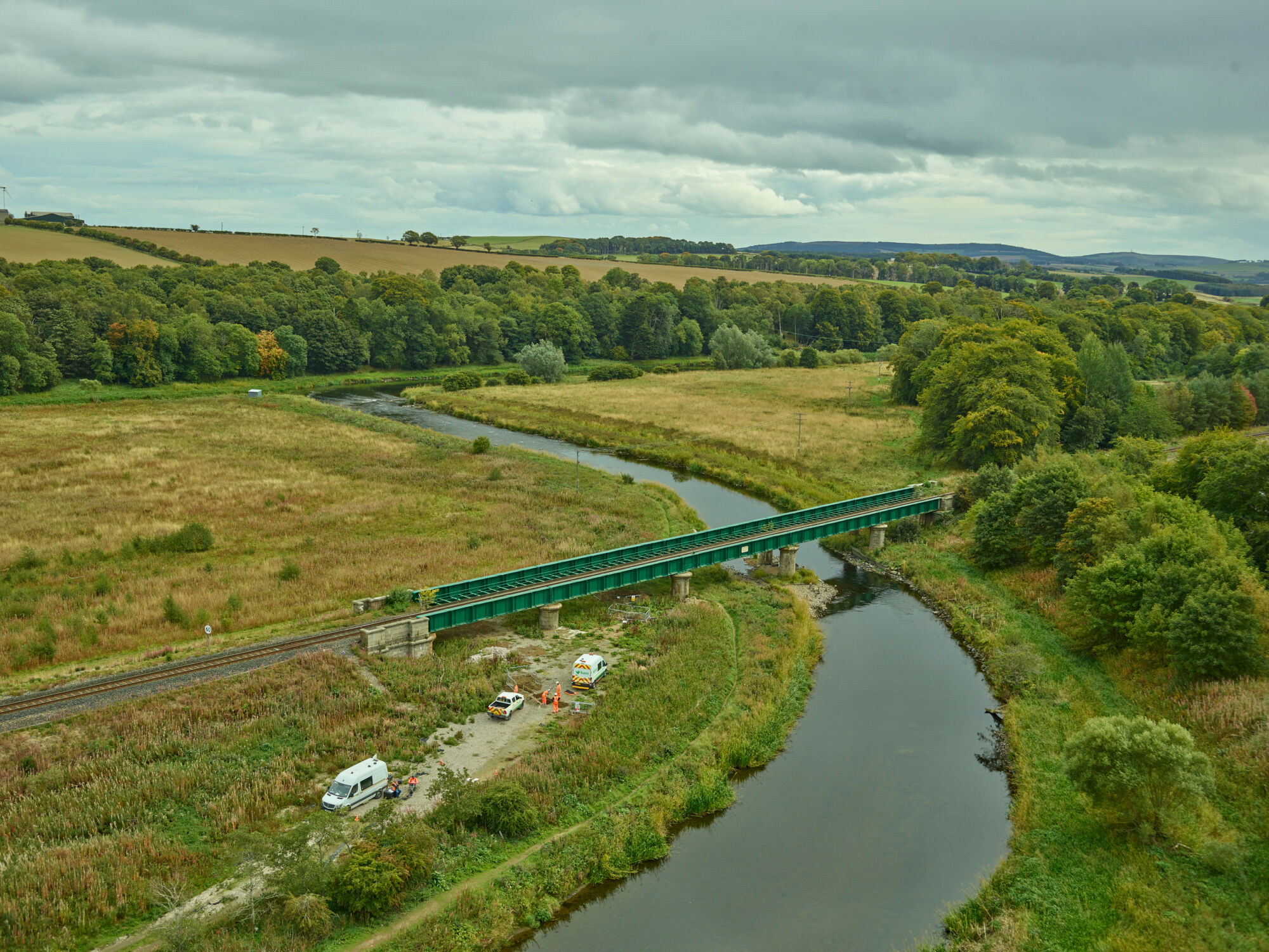
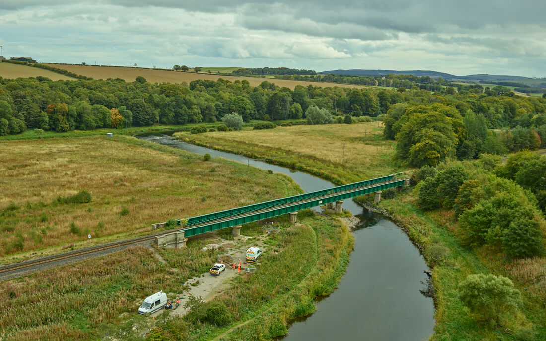
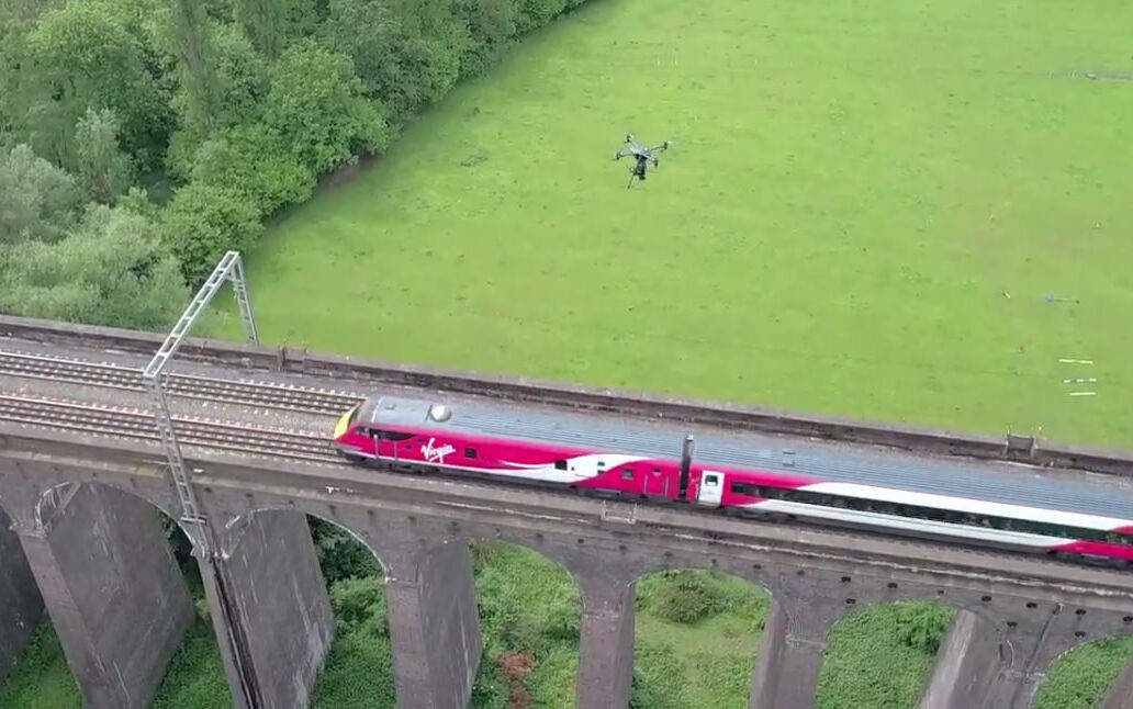
With the iconic Don Viaduct needing to have a second track added, we were contracted to carry out a high-accuracy, sub-5mm drone survey of the bridge that would in the first instance assess the state of the structure.
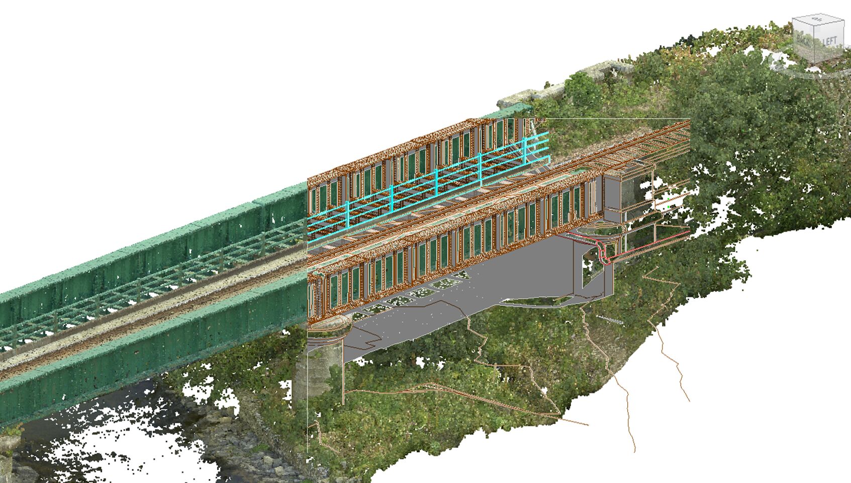
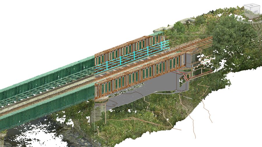
This was done using our Vogel R3D drone survey solution, with the resulting data being used to produce an information-rich 3D BIM model of the bridge and the surrounding areas that enabled design works for the upgrade as well as the future management of the structure.
Related content
How did we do it?
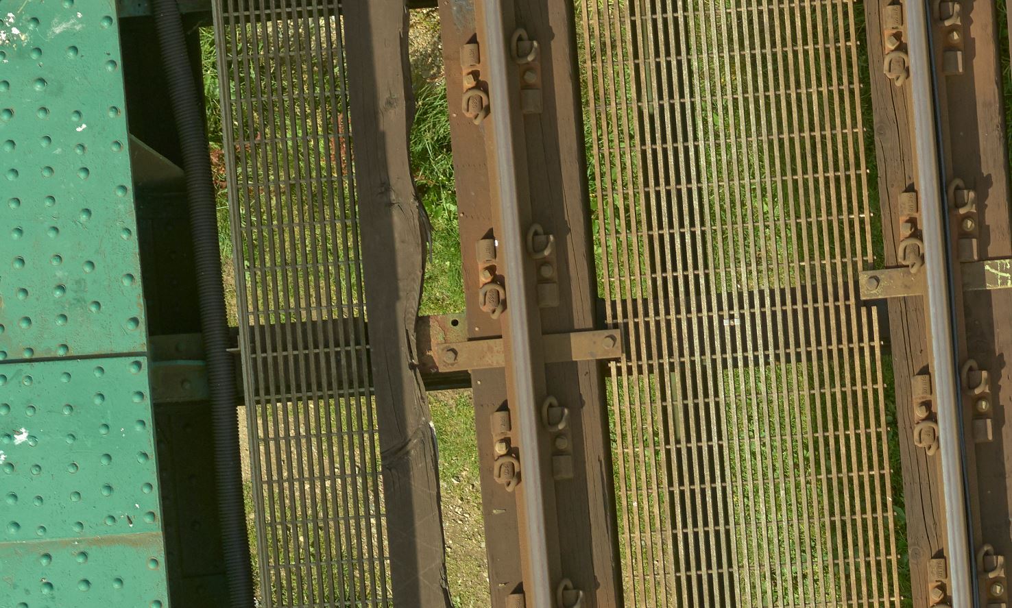
By using a drone to capture the majority of the data, significant time, cost and safety savings can be made. Once survey control had been put in place on the ground, our dedicated UAV team was able to rapidly survey the entire site – tracks and all – without the need for ‘boots on ballast’ or closure of the line.
Flying from a position of safety, our award-winning Vogel R3D is the only UAV-based survey solution verified as able to capture data to Network Rail’s Band 1 accuracy level of sub-5mm.
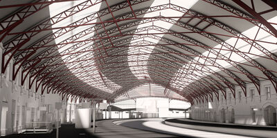
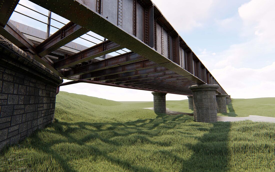
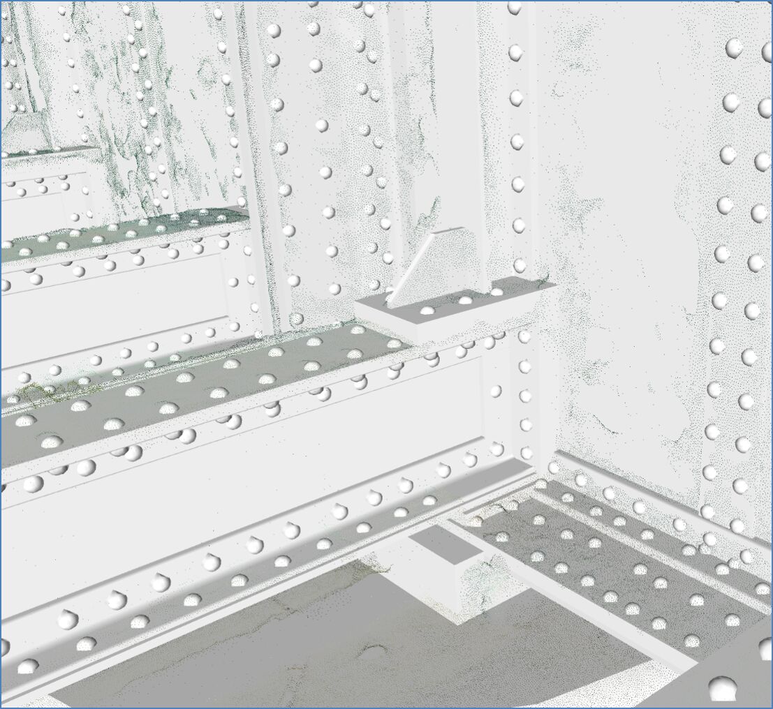
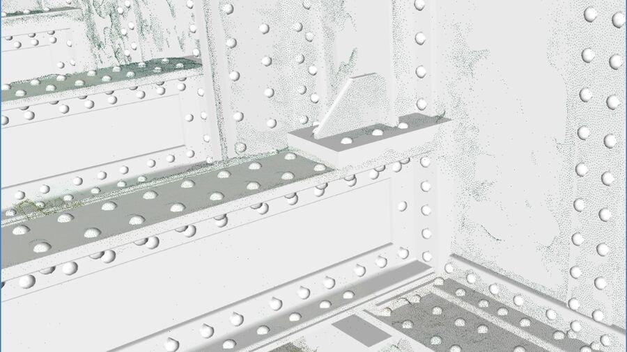
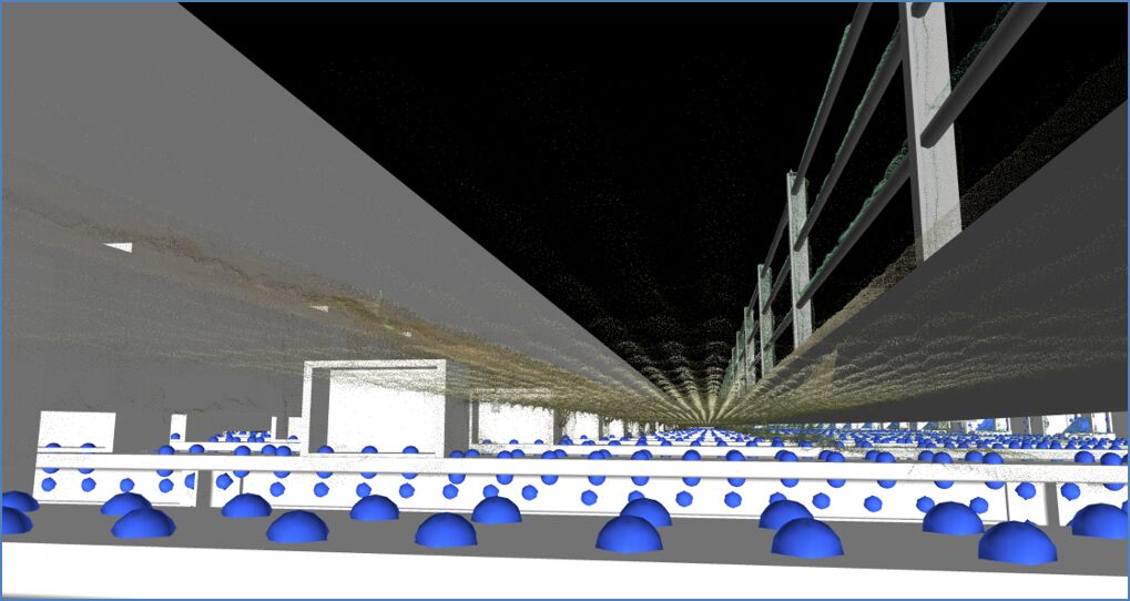
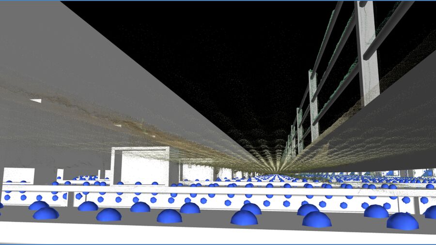
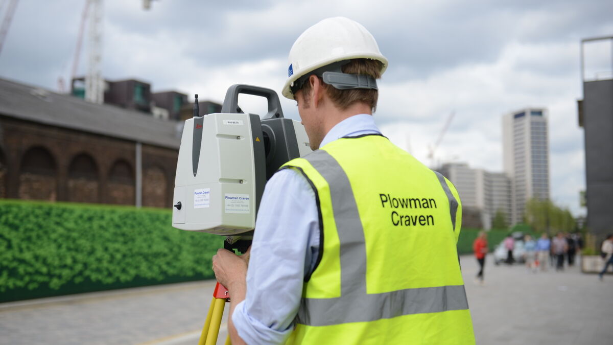
To ensure nothing was missed, we then terrestrially laser-scanned at ground level to capture the underside of the bridge, the supports and the surrounding topography. The point clouds from both surveys were then combined into one point cloud database and from that a topographical survey of the site and a BIM model in Revit of the viaduct and its supports were extracted.

Why BIM?
Using the data captured during the drone survey, Plowman Craven’s expert BIM team was able to model every single component of the structure, right down to all 80,000 individual rivets.
All of these components are classified, meaning the entire model can be viewed, interrogated, measured, marked-up and even walked through by anybody at any time - removing the need to revisit the site at a later date. That is invaluable on a project with multiple stakeholders in different locations.
Creating such a highly-detailed digital survey model early in the process ensured maximum value for the client. The intelligence now obtainable – such as the requirement for parts to be replaced or repaired - has enabled the future manageability of the asset and helped all interested parties, from designers to project managers, to make more informed decisions.
> Plowman Craven's BIM Centre of Excellence
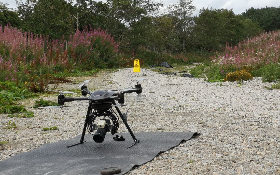
Meet the Vogel R3D Drone Survey Solution...
Plowman Craven's Vogel R3D enables rapid and comprehensive drone surveys of rail infrastructure to a sub-5mm accuracy. Click for more info...
- Removes the need to physically access the tracks
- Reduces the expense of possessions and line blocks
- Rapid data capture shortens programmes
- HD photography supplements current survey deliverables
- Accuracy meets Network Rail Band 1 requirement

The project displayed commendable collaborative working on an exacting timescale with an invaluable contribution by Plowman Craven.
Jack Mitchell, Digital Construction Manager, BAM Nuttall Rail Projects SNE

Additional Benefits...
As well as helping with design and asset management, the model and accompanying 360/panoramic imagery has a range of other benefits from site visualisations to logistics planning.
For example, on this project we mocked up a theoretical scaffold bridge in the model to show how the scaffold would look. We factored in how the water level of the river may affect the integrity of the scaffold – something the client was extremely interested in understanding.
We conducted a costing exercise of how much it might cost to paint the bridge, using the model to calculate the exact surface area, the volume of paint required, how long it would take to do and what the cost implications for this would be. This feeds into 4D Construction Sequencing, providing an intelligent visual of the project timeline.
We also showed the animated fly-through to both Network Rail and BAM Nuttall, during which an environmental expert spotted an invasive species – something that could have taken weeks to manually search for.
You may also be interested in....
Battersea Pier UAS Survey
Conducting a high-accuracy UAV survey of critical rail infrastructure for Network Rail at Battersea Bridge presented a raft of challenges. … Find out more
Guildford Station
We delivered a range of survey requirements that would enable the replacement of S&C close to Guildford Station in Surrey… Find out more
Taking to the Skies
Network Rail's Thameslink Project Sponsor, Paul Ashman, explains how Plowman Craven's Vogel R3D advanced drone survey system perfectly illustrates its commitment to innovation. … Find out more
Let’s discuss your requirements
Let’s discuss your requirements and see how our expertise will deliver trusted results throughout the project lifecycle.
Plowman Craven has more than 50 years’ experience, we provide integrated measurement and consultancy services.
