Elephant & Castle Utilities Survey
View project
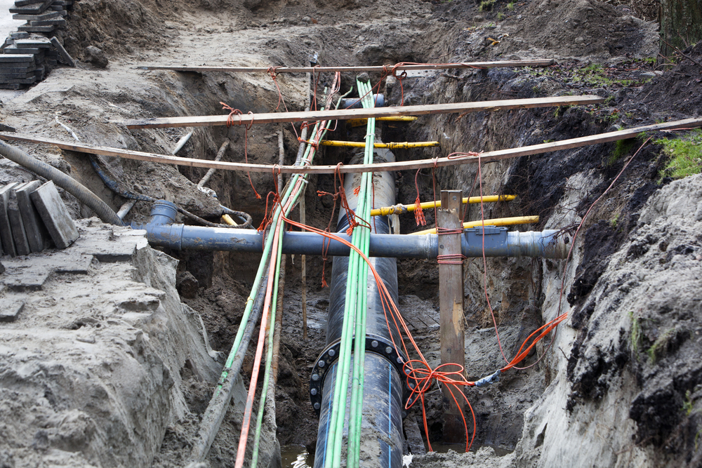
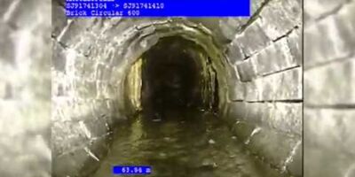
The urban underground environment is a spider web of utility infrastructure where telecommunication, electricity, gas, water and cable TV grids compete for space with drainage, rail networks and road tunnels. Ongoing development of utility services puts a further strain on underground space requirements as multiple providers seek to deploy parallel networks. As the number of underground networks grows, so does the risk of accidental damage to existing infrastructure.
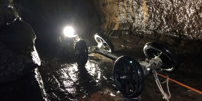
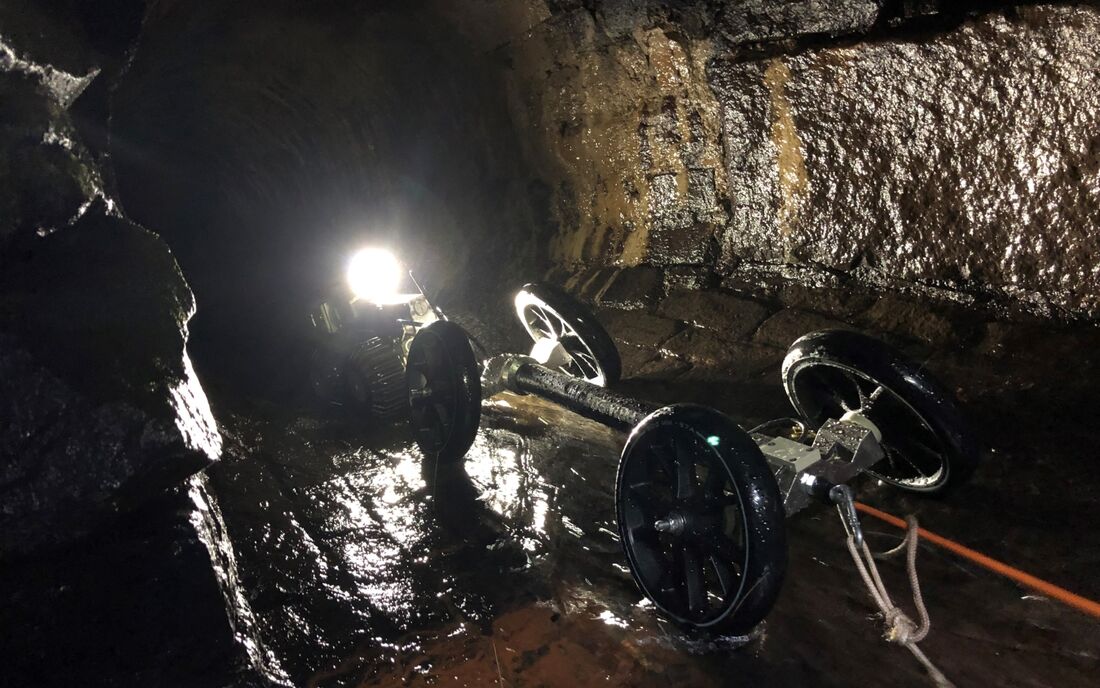
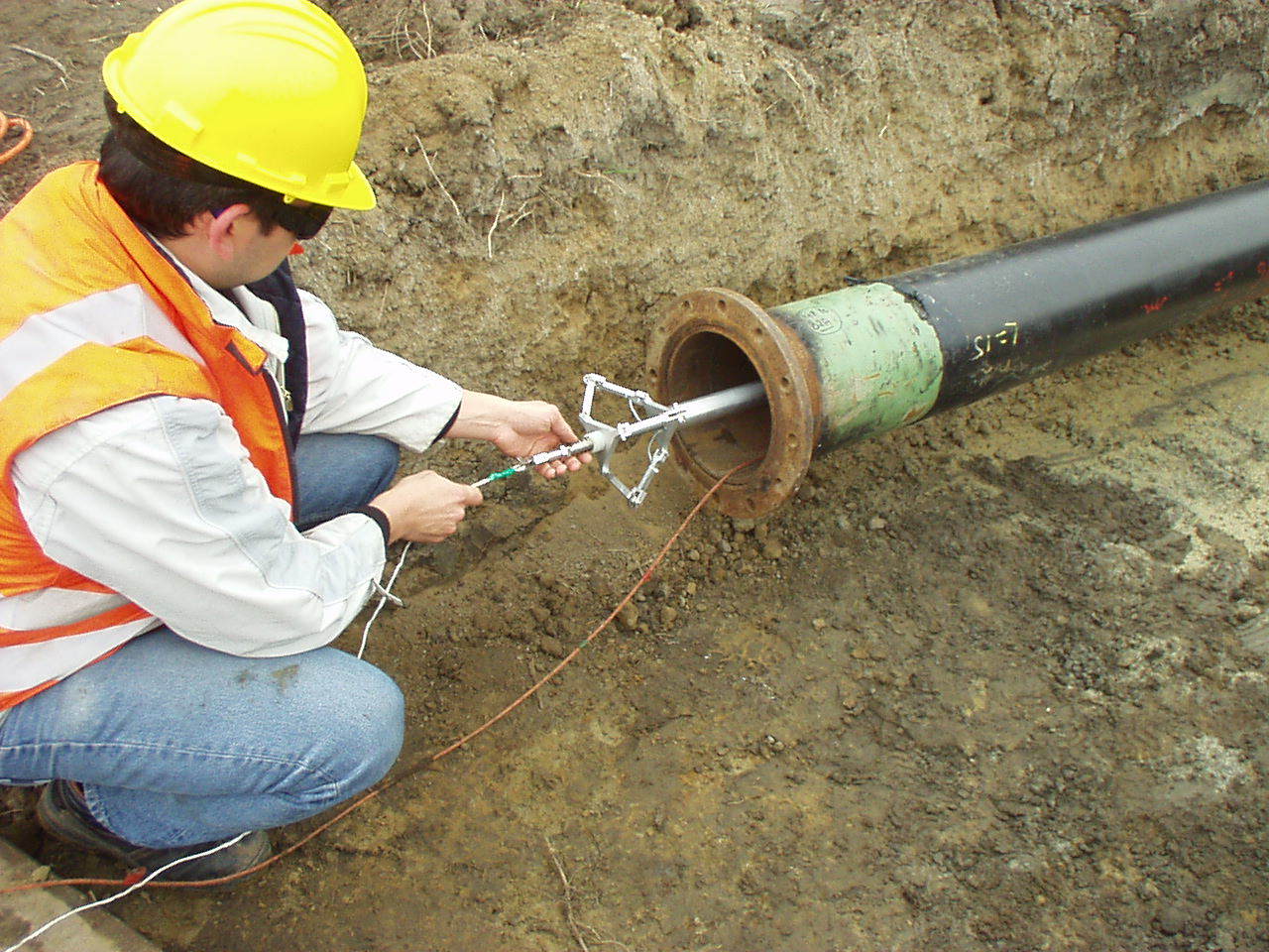
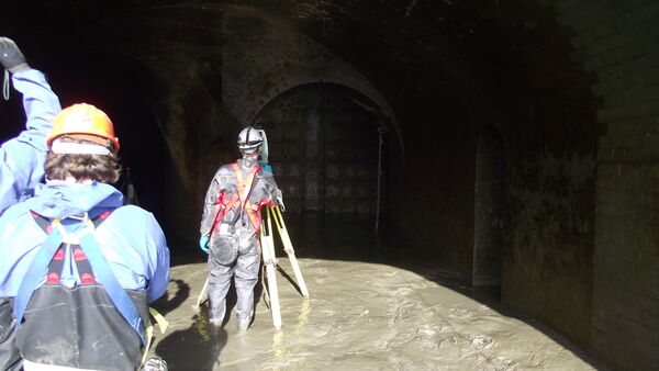
It is clear that the need for accurate mapping of networks becomes critical for operational, maintenance and insurance purposes or prior to new building developments and construction nearby. Plowman Craven utilises a gyroscope-based system that has been developed for off-line positional recording to record the position of sewers, ducts, pipelines and tunnels.
The Plowman Craven gyroscopic mapping service allows accurate tracing and mapping of underground pipelines, sewers, ducts and tunnels without the need for topside personnel to follow along the path of the pipeline to map the utilities.
The gyroscopic probe is autonomous, so it can travel to any depth and underneath any obstacle, such as rivers, railways, roads or buildings. This technology is not dependent on GPS technology while logging so it is ideal for these underground applications.
Plowman Craven is able to get the exact measurement of the pipe’s centreline. Unlike GPR and electro-detection methods, our gyroscope-based system is not susceptible to electromagnetic interference, making it ideal in densely piped areas or near railways and power lines.
Plowman Craven is a member of the United Kingdom for Trenchless Technology
The course of the pipe is mapped by using a gyroscopic probe records its exact path in three dimensions between the accurately determined entry and exit points. The probe takes multiple positional recordings along its path and the software calculates the angular change compared to the previous reading. The sample length is derived from the system’s odometer.
It is not necessary to know the exact position of the probe as it travels from entry point to exit point as the software establishes where it has been after it is retrieved from the pipe.
The software converts the autonomously logged data to an accurate 3-dimensional line in the same coordinate system as the given coordinates at the entry and exit points.
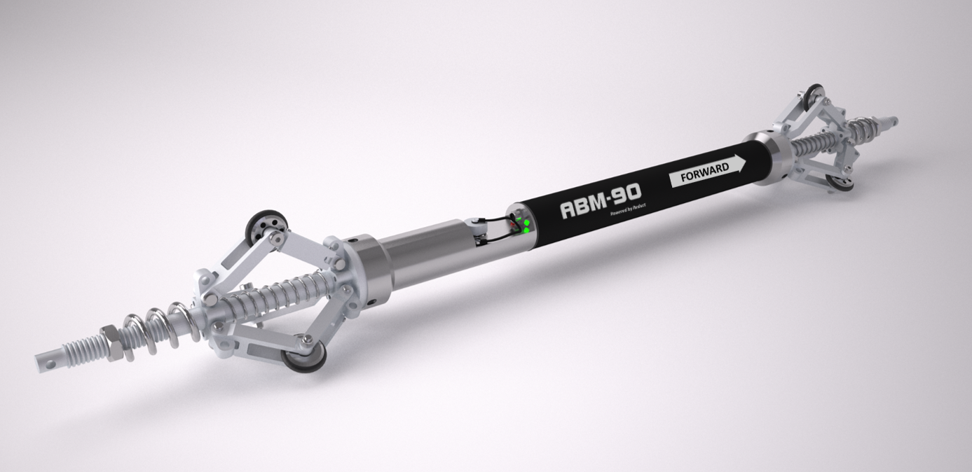
The gyroscope technology can be deployed in any duct or pipe infrastructure that has predetermined entry and exit points. The technology is not affected by electromagnetic interference and can therefore be deployed in steel pipes, near live electricity cables, near railways, etc. The probes operate autonomously, so there is no limitation to measurement depth nor does it require above ground tracing, so it can travel underneath any obstacle, such as rivers, railways, roads or buildings.
The data can be collected whenever there is access to the pipe, sewer, duct or tunnel interior. For example, during new installations, during scheduled maintenance or even when the pipe is in use.
Further information on Plowman Craven's underground utilities services.
The "heart" of the output are XYZ coordinates, which are logged 100 times per second. The software converts the measured profile automatically to the coordinate system of the entered entry and exit coordinate. Output point frequency is user defined. The coordinate files can be uploaded to any GIS platform seamlessly.
From the XYZ coordinate data set the moving pipe bend radius is calculated. Bend radius is increasingly a critical design specification for pressurized pipes. Only high frequency data forms a reliable basis to properly assess the bend radius of a pipe. The bend radius can be assessed in both two dimensions (horizontal and vertical plane) and three dimension (most accurate interpretation).
Soft ground conditions or natural disasters such as earthquakes, extreme weather, etc. can cause underground infrastructures to shift over time. Pipe shifts may have an impact on the integrity of the pipe or on the flow model associated with it. The XYZ coordinate files can be used to quickly establish the level of setting or shift of pipes against design to optimize maintenance, repair or pipeline re-lining planning.
As the only survey company in the South-East approved by Thames Water to undertake line and level sewer surveys, Plowman Craven has vast experience of working in this challenging environment.
Let’s discuss your requirements and see how our expertise in Gyroscopic Mapping Services can help on your next project.
Plowman Craven has 60 years’ experience providing integrated measurement and consultancy services to the property and infrastructure markets.