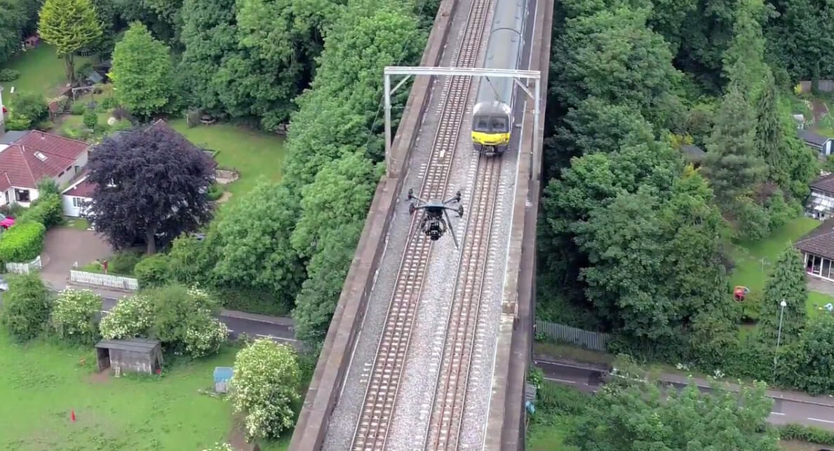
Working with BAM Nuttall and Network Rail, this video showcases the BIM model we created having surveyed the Don Viaduct in Scotland…… Watch video
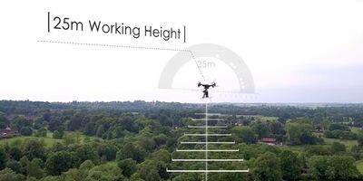
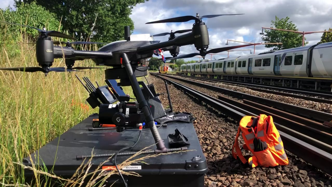
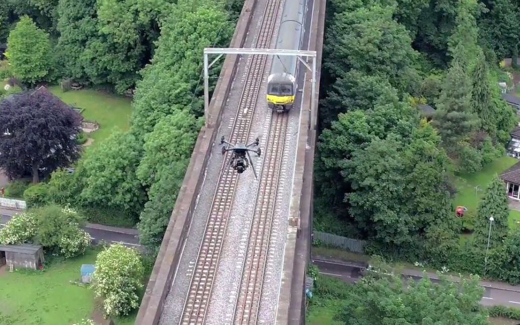
Railway track surveys can now be carried out more safely, quickly, and cost-effectively thanks to Vogel Freedom. Our new drone technology eliminates the need for track access and, with sub-5mm accuracy, it is perfect for railway track surveys. Our solution has already been adopted by Network Rail and is set to become the new industry standard for rail surveying.
Vogel Freedom is a 100% off-track survey solution, enabling faster mobilisation, taking ‘boots of ballast’ completely.
Revolutionise Rail Surveys: No More Boots on Ballast
Traditional rail track surveys are costly, time-consuming, and risky. Not only do they require boots on ballast, but they also interrupt rail services and put workers in harm's way. Surveying large sections of track can take weeks or even months, often with significant delays due to access planning. That's where Vogel Freedom comes in.
Vogel Freedom is the next UAV generation of our award-winning R3D drone service. It uses cutting-edge drone technology to survey railway tracks faster, cheaper, and safer than traditional methods. Our drones can cover large sections of track in a fraction of the time it takes for a traditional survey team to do it. Plus, because our drones can operate from a safe distance, there's no need to disrupt rail services or put workers in harm's way. And with our state-of-the-art software, you can trust that the results will be accurate and reliable.
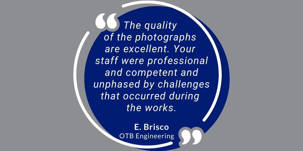
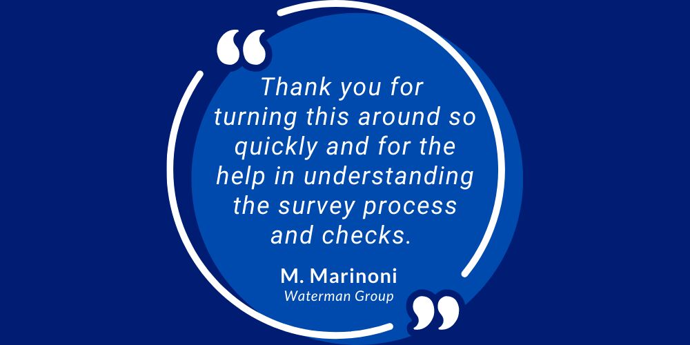
We utilised Plowman Craven’s Vogel Freedom to undertake UAV surveys on a project, called Victoria Phase 3, initially for survey and sighting location areas and access points. We found that the data could be also used in conjunction with software for Scheme Plans. The data proved invaluable for the Location Areas sighting forms and saved ‘boots on ballast’ time as some of the works was able to be completed via desk-top.”
Tony Roffey - Senior Project Manager - Siemens Mobility Limited
By using Vogel Freedom for rail track surveys, you'll discover a number of benefits. First and foremost, you'll save time and money. Our surveys are up to 30% cheaper than traditional methods and can be completed up to 20% faster. You'll also enjoy greater accuracy and reliability, thanks to our advanced technology and software. And because our drones can survey tracks without disrupting rail services, you'll avoid costly delays and minimise risks to workers.
At Plowman Craven, we are not content to rest on our laurels. We're always pushing the boundaries of what's possible with drone technology, and we're committed to staying at the forefront of the rail surveying industry. Our team of experts is constantly innovating and improving our technology to meet the evolving needs of our clients. With Vogel Freedom, you can be confident that you're getting the most advanced and effective rail surveying solutions available.
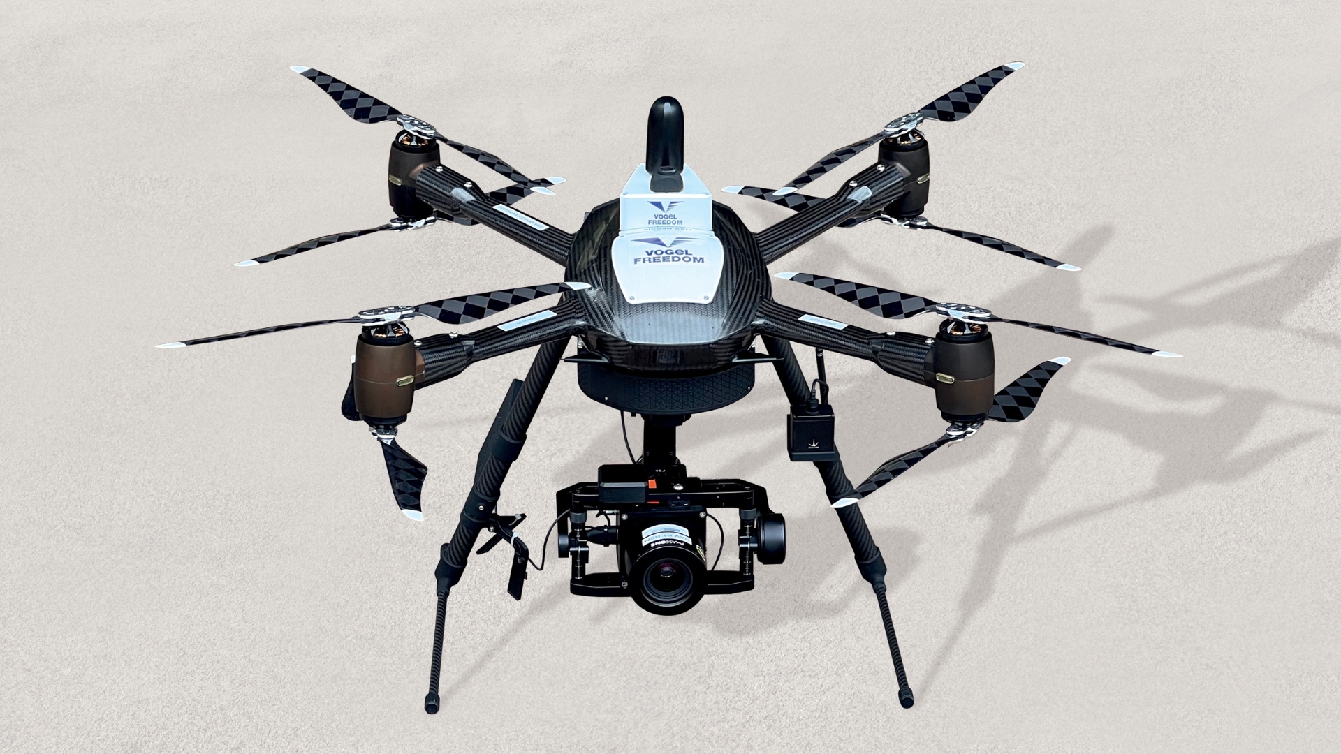
Since 2019, Plowman Craven's Vogel R3D has been at the forefront of UAV surveys up and down the UK, delivering quality rail surveys though Network Rail's UAV Framework. Vogel Freedom is our new, innovative, next-generation iteration of Vogel R3D and will continue to build on the legacy of R3D's success.
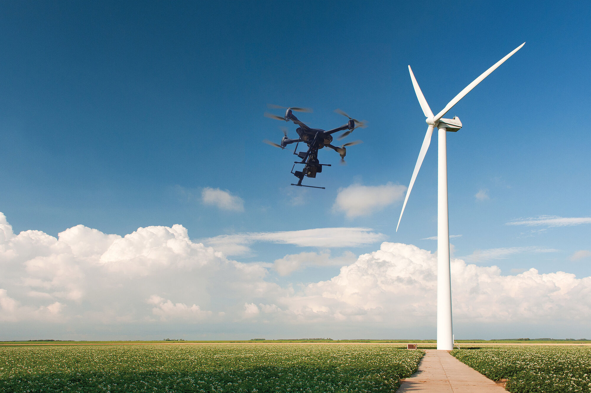
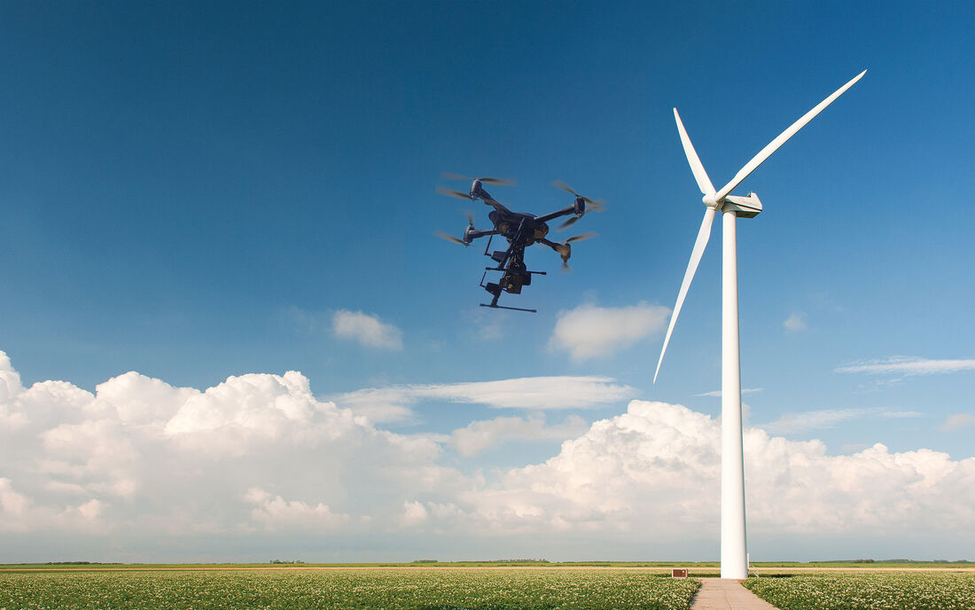
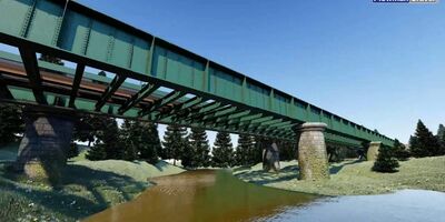
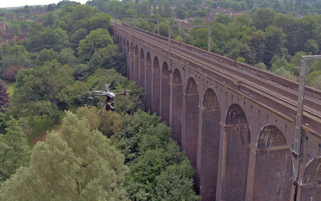
Vogel Freedom is also perfectly suited to infrastructure surveying, particularly bridges and viaducts; waterways and ports; oil rigs and power stations; wind turbines and solar farms; highways and transport.
Read about our high-precision UAV survey at Salfords Sidings
Similar to Google Street View, TruView is a web-based software package that enables stakeholders to ‘walk’ a site and even take measurements. It’s ideal for asset inspections, condition surveys and Health & Safety briefings.
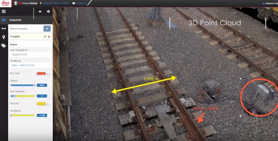
Our UAV captures both nadir and oblique images (looking straight down and at a 45° angle) to ensure every visible surface is covered.
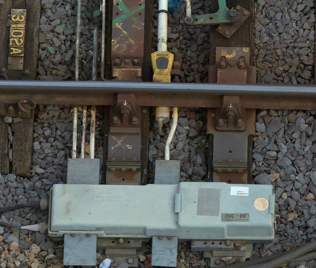
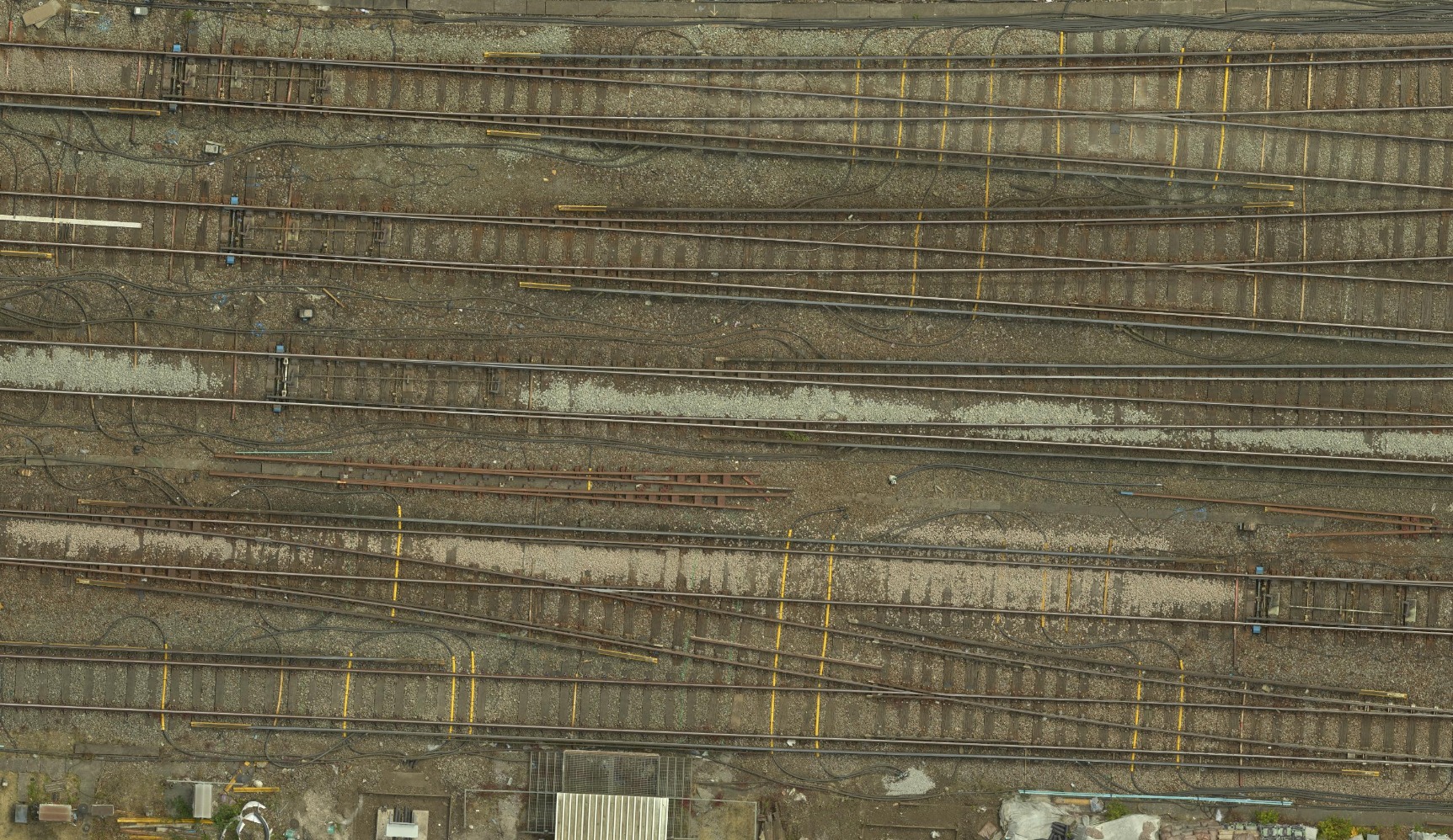
The imagery is so detailed that it’s possible to read markings on sleepers, identify specific rail clips, examine crossing noses and clearly view flash butt welds – making the job of asset inspection so much easier.
The imagery is so detailed that it’s possible to read markings on sleepers.
3D drone mapping - point cloud for use in CAD packages by designers, enabling the production of BIM (Building Information Modelling) deliverables.
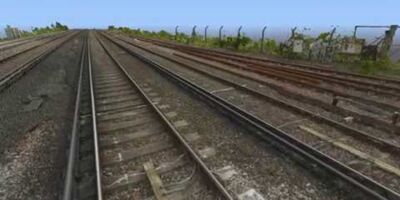
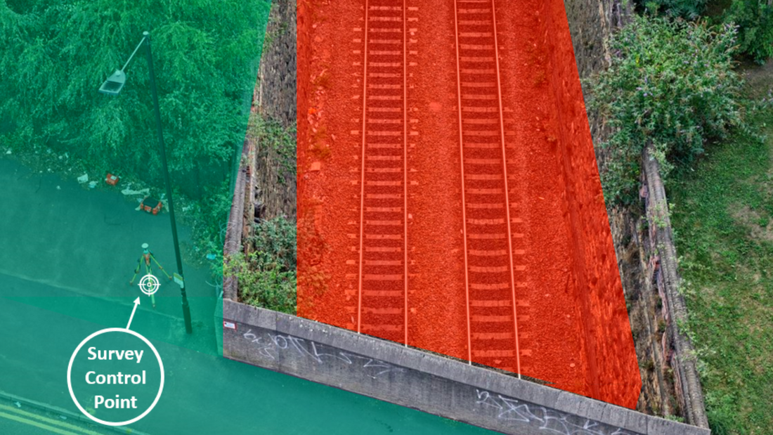
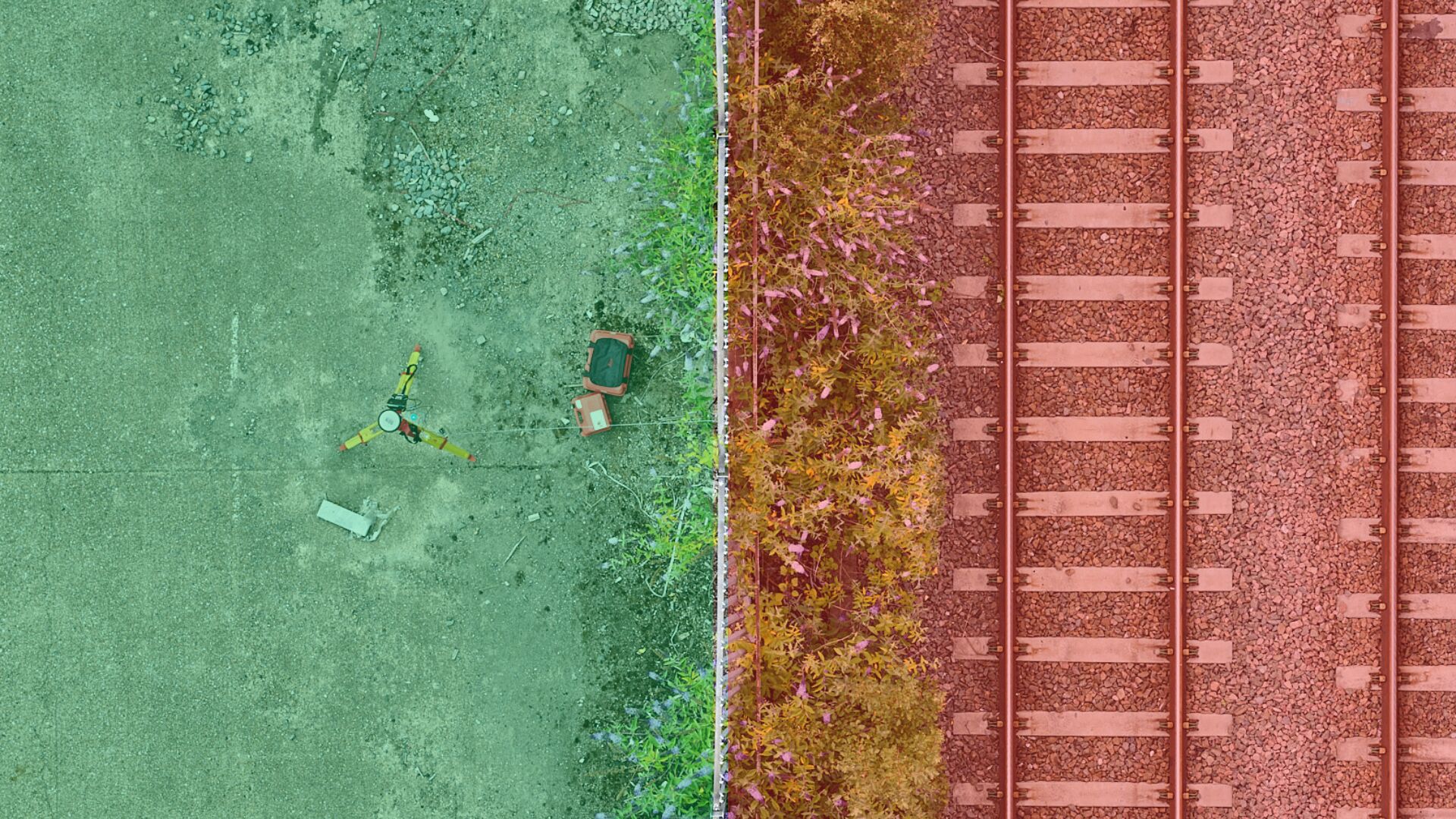
Topographical surveys cover all P-Way detail – including all tracks, switches, crossings, ties & ballast.
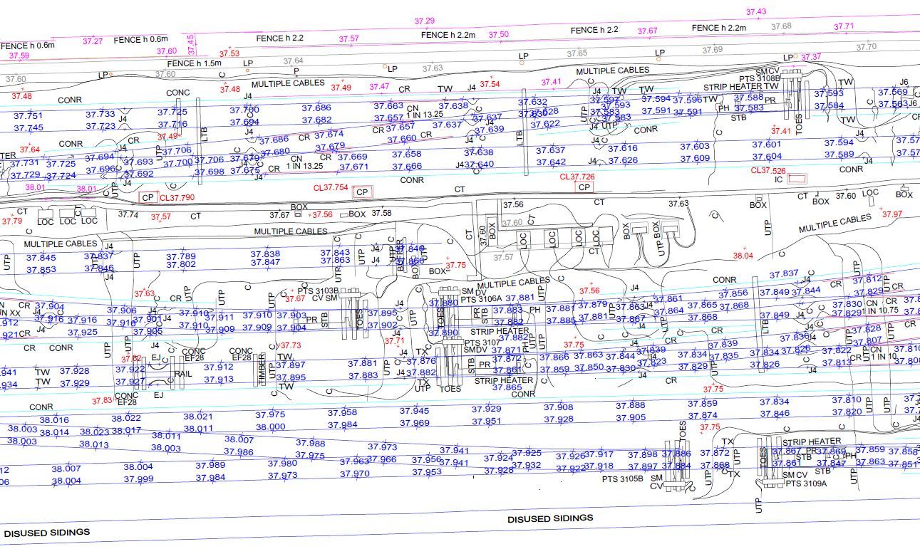
Orthophoto – true-to-scale, high-resolution image with all distortions removed so that measurements can be taken and overlaid with CAD drawings.
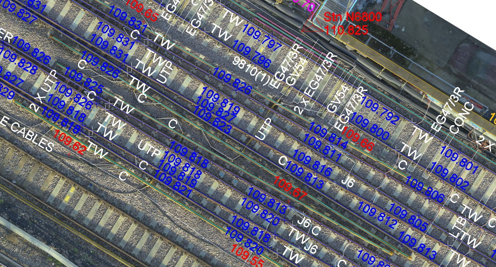
Track data is extracted from the UAV data and overlaid on a Hi-Res Orthophoto.
Download our latest brochure to find out more about how our dedicated UAV division uses the latest drone technology to provide high-accuracy surveying and inspection services to the property, rail and infrastructure markets.


Let’s discuss your requirements and see how our expertise can help on your next project.
Plowman Craven has more than 50 years’ experience providing integrated measurement and consultancy services to the property and infrastructure markets.